Disaster Management
Land Slide Prediction
Satellite-based landslide prediction enables early detection of unstable terrain by analyzing key factors such as slope movement, soil moisture, geological conditions, and vegetation changes. Advanced remote sensing and AI-driven analysis help identify high-risk zones, providing critical insights for disaster preparedness. Early warnings enable proactive mitigation, reducing potential damage and ensuring the safety of infrastructure and communities.
INSAR Prediction
Glacial lake outburst flood (GLOF)
GLOFs pose significant threats to downstream communities. Remote sensing techniques, including satellite imagery and radar data, enable real-time monitoring of glacial lakes, detecting water level changes and early warning signs. Advanced GIS analysis enhances risk assessment, helping mitigate disasters and improve resilience in vulnerable mountainous regions.
Deformation Analysis using InSAR

Slope Stability (Mining, Highways)
InSAR (Interferometric Synthetic Aperture Radar) technology enables precise monitoring of slope stability in mining and highway projects. By detecting ground deformations over time, it helps predict landslides, ensuring safety and infrastructure resilience. Its remote sensing capability provides cost-effective, real-time data for proactive risk management and disaster prevention.
Deformation Analysis using InSAR
Flood prediction and damage assessment
Our advanced flood prediction and damage analysis system uses real-time data and AI to forecast floods accurately. It helps communities prepare, minimize damage, and enhance disaster response. With cutting-edge technology, we provide early warnings and detailed impact assessments to safeguard lives, property, and infrastructure. Stay informed, stay safe!
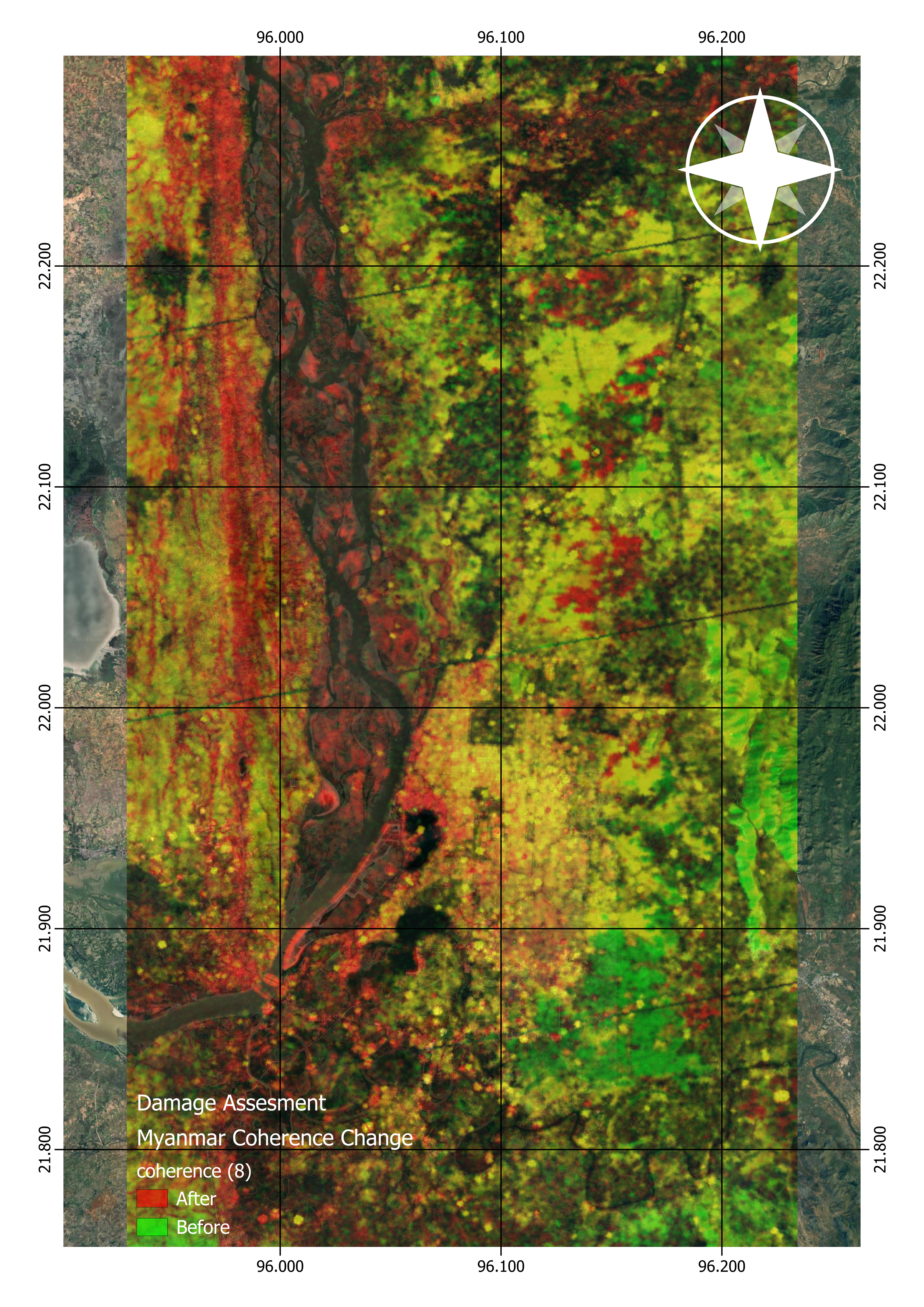
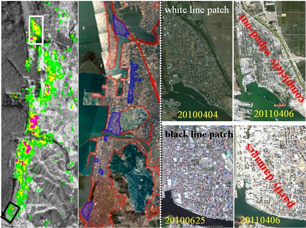
Damage Analysis using InSAR
Damage analysis
We provide advanced damage analysis using InSAR technology for manmade and natural hazards. Our precise satellite-based monitoring detects ground deformations, infrastructure damage, and disaster impacts in real time. Whether it's earthquakes, landslides, or subsidence, our expert insights help in risk assessment, mitigation, and recovery planning. Contact us today!
Original Cityscape