Forestry
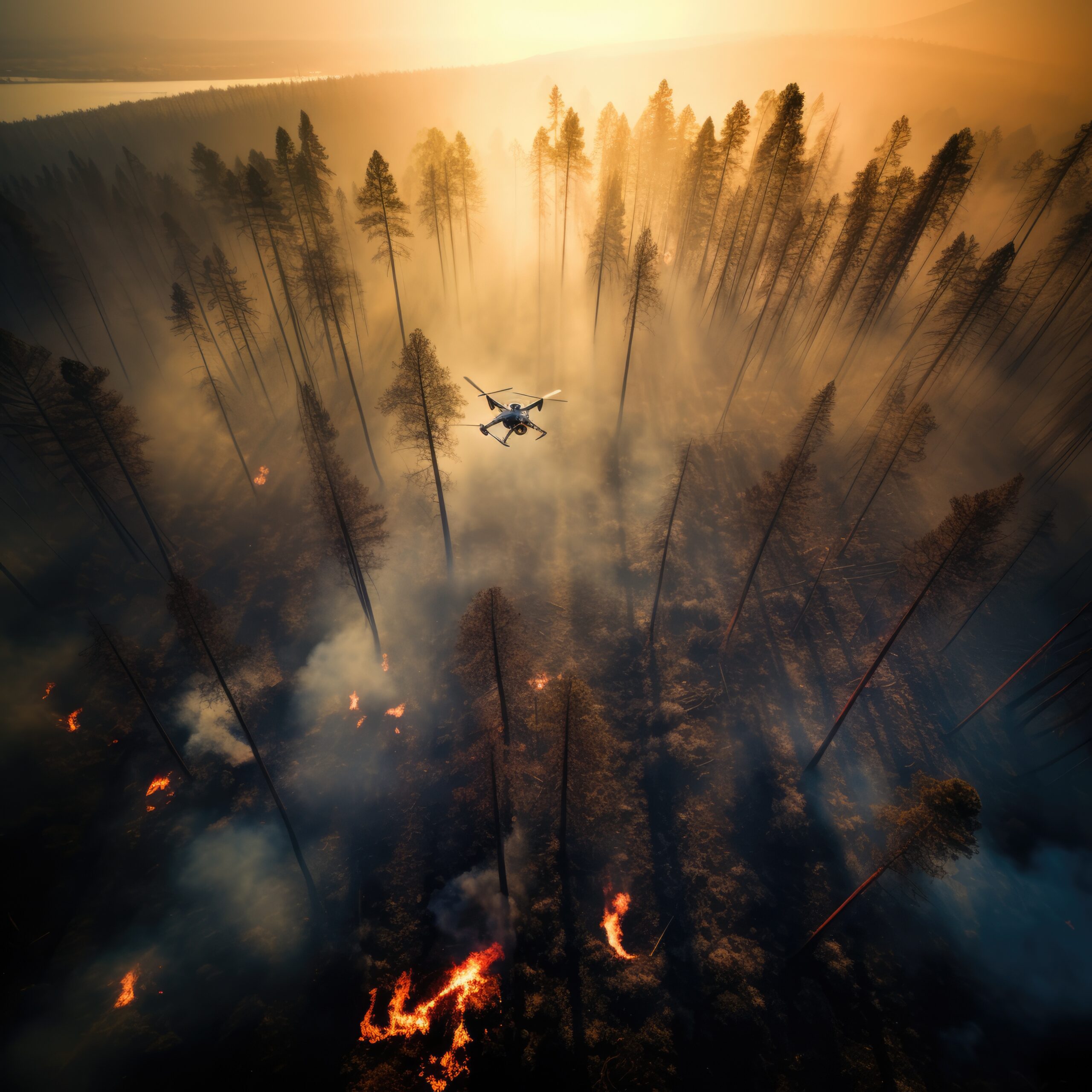
Forest Fire
Detecting and monitoring forest fires is critical for minimizing damage and ensuring rapid response. Using satellite-based thermal imaging, remote sensing, and AI-driven analytics, early warning systems can identify heat anomalies, smoke patterns, and vegetation dryness. Real-time monitoring enables swift action, reducing the spread of wildfires, protecting ecosystems, and enhancing disaster management efforts for environmental and human safety.
Original Cityscape
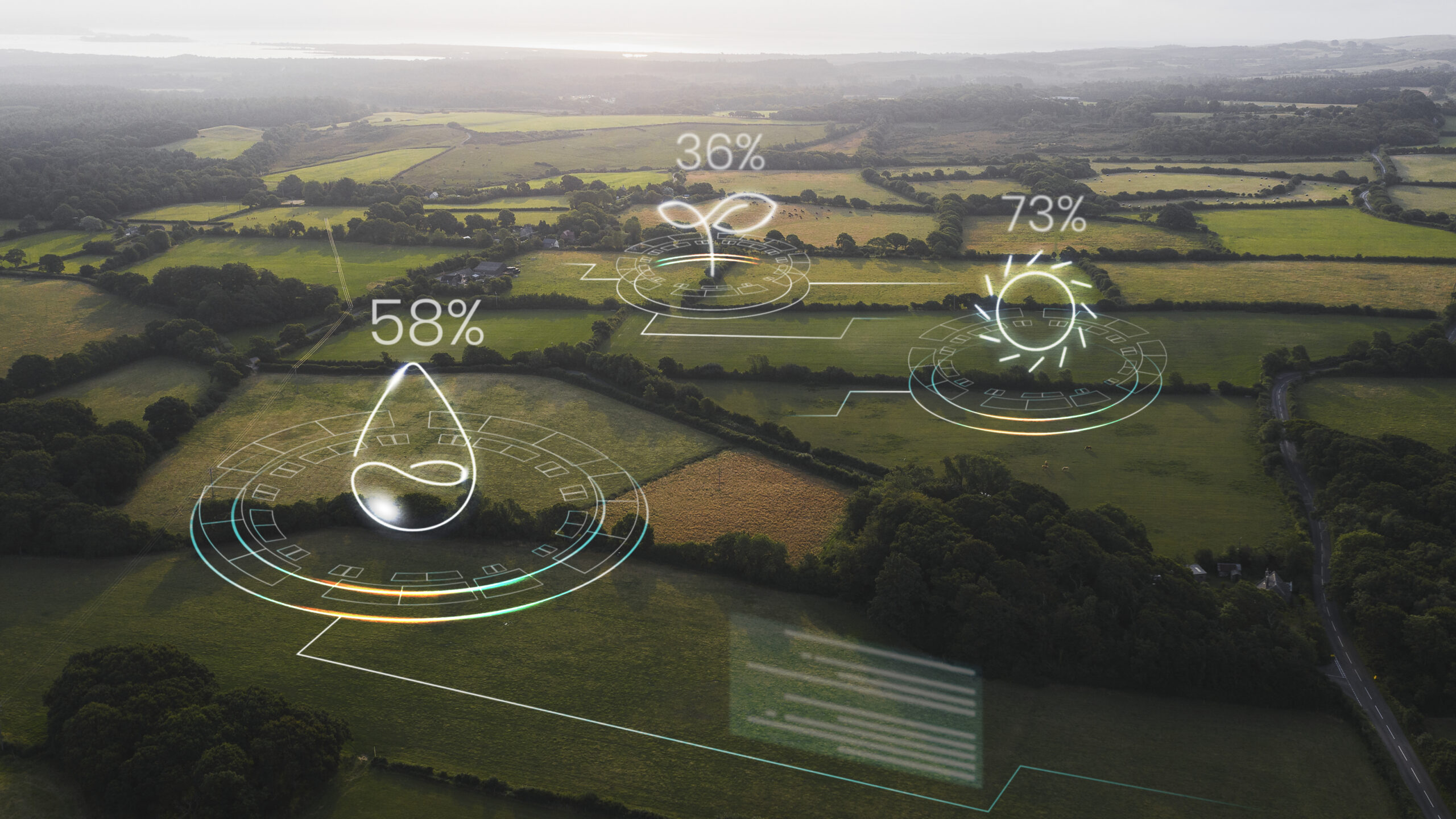
Biomass estimation
Accurate biomass estimation is essential for assessing carbon stocks, monitoring deforestation, and supporting sustainable land management. Using satellite-based remote sensing, LiDAR, and multispectral imaging, vegetation density and biomass distribution can be analyzed in real time. Advanced AI-driven models enhance accuracy by integrating climate, soil, and topographic data, enabling precise estimations that aid in environmental conservation and resource planning.
Biomass Estimation
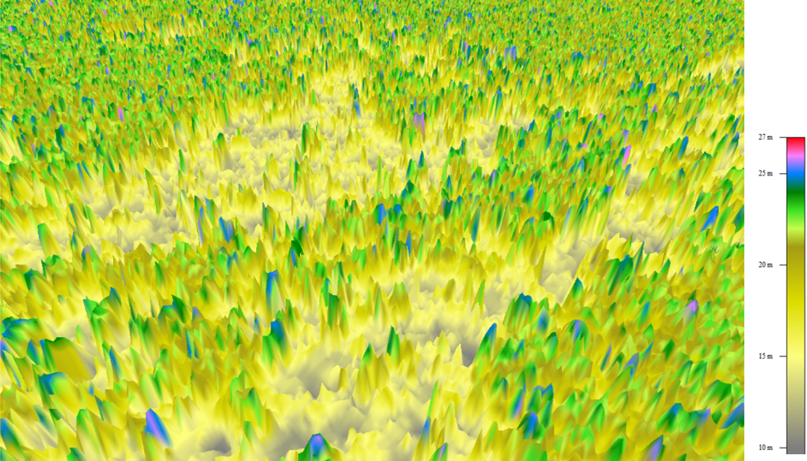
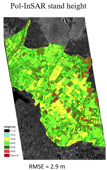
Height estimation
Forest height estimation is crucial for assessing ecosystem health, carbon sequestration, and biodiversity conservation. Utilizing LiDAR, satellite imagery, and radar-based remote sensing, accurate height measurements of tree canopies can be obtained. Advanced AI-driven analytics integrate topographic and climatic data to improve precision, enabling better forest management, deforestation monitoring, and environmental sustainability efforts.
Forest Degradation
Forest degradation monitoring is essential for assessing environmental impact, biodiversity loss, and climate change effects. Using satellite remote sensing, multispectral imaging, and AI-driven analysis, changes in vegetation cover, deforestation, and soil degradation can be detected in real time. Continuous monitoring enables early intervention, supports conservation efforts, and promotes sustainable forest management to mitigate ecological damage.
Original Cityscape

Deformation Analysis using InSAR
Carbon Credit Analysis
Carbon credit analysis is essential for tracking carbon emissions, offsets, and sustainability compliance. Using satellite remote sensing, LiDAR, and AI-driven analytics, carbon sequestration in forests, agricultural lands, and industrial zones can be accurately measured. Real-time monitoring ensures transparency, supports carbon trading mechanisms, and helps organizations achieve climate goals by validating emission reductions and promoting sustainable practices.
Deformation Analysis using InSAR